$17,999.00Original price was: $17,999.00.$14,999.00Current price is: $14,999.00.
In stock
Trimble SX10 instrument quickly creates a point cloud with millions of points of the retaining wall and combines surveying, imaging, and 3D scanning into one instrument
Trimble SX10 instrument quickly creates a point cloud with millions of points of the retaining wall. The point cloud is, in essence, a three-dimensional rendering of the retaining wall that resembles a photo. The Trimble SX10 is also a Robotic Total Station, which allows us to collect data conventionally. This allows us to complete a project of this nature with one piece of equipment and therefore saves our patrons money.
SX10 combines surveying, imaging, and 3D scanning into one instrument, and helped collect data points of the retaining wall, which has multiple layers and varying textures along the wall.
We’re confident we can provide the highest quality of surveying services to all of our projects, no matter the type, and we’re able to do that with current technology and software like the Trimble SX10 Scanner.
Trimble SX10 which was launched on the market in early October 2016 has been tested and some experiences carried out with it are reported in this paper. The analyses mainly focus on the survey of a building facade. Next to the laser scanning survey, a photogrammetry campaign using an Unmanned Aerial Vehicle (UAV) has been carried out. These different datasets are used to assess the Trimble SX10 issued point clouds through a set of comparisons. Since georeferencing is possible either directly or indirectly using this device, data processed both ways are also compared to conclude about the more reliable method.
Trimble SX10 Key Features:
Combines surveying, imaging, and high-speed 3D scanning in one revolutionary solution.
Trimble’s high accuracy Lightning 3DM technology provides a scanning range up to 600 m and the smallest spot size in the industry—a mere 14 mm at 100 m.
Utilizes Trimble Lightning scanning technology to scan up to 26,600 points per second captures a full-dome scan in as little as 12 minutes.
Improved Trimble VISION™ technology allows for fast and easy capture of high-resolution site imagery.
Complete integration with familiar workflows of Trimble Access and Trimble Business Center Software.
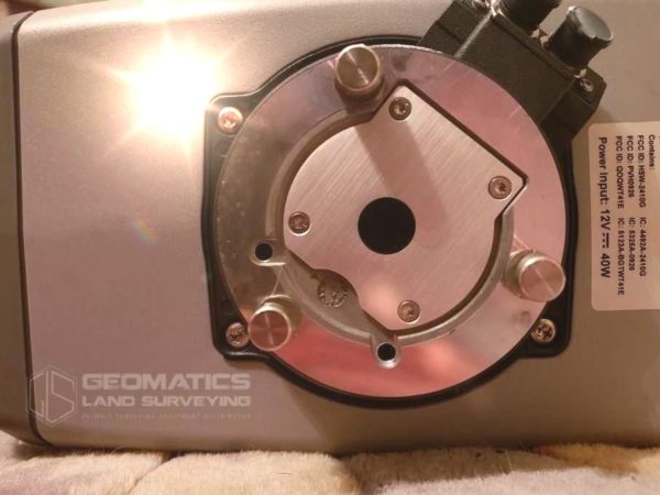
3D Scanner and a Total Station in One Device
Used Trimble SX10 combines high-speed 3D scanning, enhanced Trimble VISION imaging technology, and high-accuracy total station measurements into the familiar area and office workflows for surveyors.
The innovative solution supplies surveyors and geospatial professionals together with the abilities and versatility to deal with jobs from conventional surveys to complex 3D modeling.
This configuration enables surveyors to gather camera images in addition to the exact 3D dimension in the area without adding any steps to their conventional surveying workflows. Used Trimble SX10 Scanning Total Station to capture both higher precision total station measurements and true high-speed 3D scans together in a single instrument.
Trimble SX10 is right for you:
You’d like to expand the services and deliverables you offer to customers and grow your business.
You’d like to offer 3D scanning services, but you’re not familiar or quite confident with the workflow.
You already know how to use Trimble Access or another field workflow, and you’d like an easy introduction to 3D scanning work.
You don’t have a 3D scanner yet, but you’d like to have one in the future.
Most of your work requires a high-accuracy total station, but occasionally you also need a rapid and precise 3D scanning solution.
You need a high-accuracy (1”) total station but you can’t justify the expense of a standalone 3D scanner.
Specs and Compatibility
This Employed SX10 steps at 26,600 points each second, with a 360° by 300° area of view. It scans at a range of 600 meters, using a spot size of 14 millimeters in 100 meters.
Trimble touts the SX10 as having no learning curve, as it integrates directly with the Trimble software which their customers are already utilizing.
Specs
Angular Accuracy 5″
Compensator Centered dual-axis
Scan Speed Up to 26,600 Hz at ranges up to 600 m
Built-in Colour Camera Yes
Scanning Yes
Operating Temperature –20 °C to 50 °C
Battery Life One internal battery: Approx. 2–3 hours
IP Rating IP55
Plummet Type Built-in video plummet, Split optics tribrach with optical plummet
A robotic total station along with a fully working scanner
Used Trimble SX10 is also an entire channel, resolving the job registration on precisely the same tool as the scans and images with a density more suitable for the engineers’ requirements.
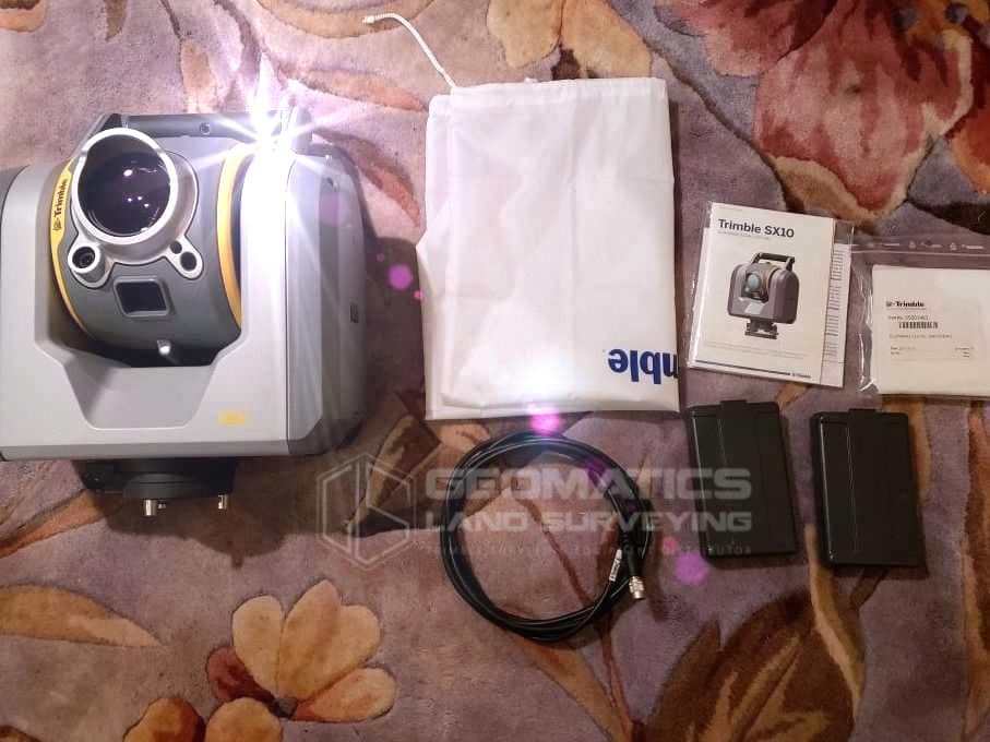
INCLUDE:
1 – Trimble SX10 1″ Scanning Total Station
– High-Speed 3D Scanning & Imaging
– Internal 2.4 GHz Radio w/ Antenna
– Enhanced Vision & WiFi Enabled
– 26,600Hz High Precision Scan w/ Range of 600m
– Current Calibration
– Accuracy: Within 3/32″ or 2.7mm at 500ft
2 – Trimble Total Station Batteries
1 – Dual Battery Charger w/ Power Supply
1 – Trimble 360° Prism
1 – Trimble Transport Case
TSC7 A/C Adapter
Pair of TSC7 Batteries
Trimble TSC7 Package with Robotic Module and Antenna (Roads, Tunnels, Mines and Pipelines module)
Currently owned by a Land Surveying Firm. Great piece of equipment. Sold as-is. Geomatics Land Surveying Distribute solutions for a global customer from governments, schools, construction projects, and transportation.


There are no reviews yet.