Die 5 besten Trimble-GPS-Geräte für die Vermessung: Präzise Lösungen für jeden Vermessungsingenieur
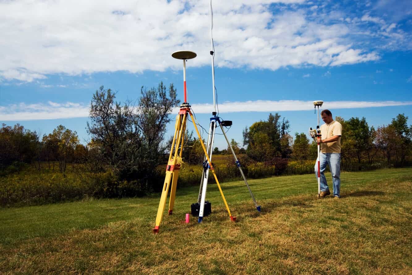
In der Vermessungsbranche stehen Präzision und Zuverlässigkeit an erster Stelle. Viele GPS-Systeme Hilfe bei der Vermessung, aber Trimble ist führend. Sie bieten verschiedene Modelle für spezifische Projektanforderungen an. Ob in einer geschäftigen Stadt oder einem schwierigen, abgelegenen Gebiet – die Wahl des richtigen Trimble-GPS kann zum Erfolg Ihres Projekts beitragen.
Dieser Trimble-GPS-Vergleichsleitfaden führt die fünf besten Trimble-GPS-Optionen für die Vermessung auf. Finden Sie heraus, welches Produkt am besten zu Ihrem Team passt.
Warum Trimble ein führender Anbieter von GPS-Technologie für die Vermessung ist
Gegründet 1978, Trimble ist seit langem für sein Engagement für Innovation und Präzision bei georeferenzierten Lösungen bekannt. Trimble entwickelte 1984 den weltweit ersten kommerziellen GPS-Empfänger und revolutionierte damit die Vermessungs- und Kartierungstechnologie. Seitdem sind ihre GPS-Systeme zum Synonym für Präzision und Zuverlässigkeit geworden. Trimble-GPS-Systeme bieten die folgenden Hauptvorteile:
- Fortschrittliche Technologie Trimble integriert wichtige Funktionen wie die ProPoint™ Global Navigation Satellite System (GNSS)-Technologie und die Trimble Inertial Platform (TIP) für verbesserte Genauigkeit.
- Langlebige Designs Trimble entwickelt seine Produkte so, dass sie rauen Einsatzbedingungen standhalten, was ihre Langlebigkeit und Gebrauchstauglichkeit in realen Anwendungen gewährleistet.
- Vielseitigkeit Trimble bietet Lösungen, die für verschiedene Projektanforderungen geeignet sind, von Bauwesen bis hin zu Umweltstudien.
So wählen Sie das richtige Trimble-GPS für Vermessungsarbeiten aus
Trimble hat verschiedene GPS-Produkte für Vermessungsingenieure entwickelt. Diese Werkzeuge helfen Ihnen, bei der Arbeit präzise Daten zu erfassen und auszuwerten. Ihre Geotechnologie kann dabei helfen, raumbezogene Daten in aussagekräftige Informationen umzuwandeln.
Jede neue GNSS-Lösung ist auf spezifische Projektanforderungen zugeschnitten, daher ist es wichtig, Ihre Optionen zu vergleichen.
Bei der Auswahl eines Trimble-GPS sollten Sie Folgendes berücksichtigen:
- ProjektanforderungenBeginnen Sie damit, die von Ihrem Projekt geforderte Genauigkeit und die Beschaffenheit des Geländes zu bewerten. Einige Trimble-Produkte konzentrieren sich stärker auf hohe Präzision, während andere leichte, kompakte Optionen bieten.
- BudgetTrimble bietet Modelle zu unterschiedlichen Preisen an. Bei der Auswahl eines Modells ist es wichtig, Funktionen und Kosten abzuwägen.
- Verbindungsbedarf: Beurteilen Sie, ob die Echtzeit-Datenübertragung oder die Integration mit anderen Geräten essenziell ist.
- BenutzerfreundlichkeitBerücksichtigen Sie bei jedem Produkt die Lernkurve und die Benutzeroberfläche. Dies ist besonders wichtig, wenn Ihr Projekt mehrere Teammitglieder erfordert, um das Gerät zu bedienen.
Die 5 besten Trimble GPS-Modelle für Vermessungsarbeiten
Trimble bietet eine Vielzahl von Vermessungsgeräten für unterschiedliche Feldbedingungen und Arbeitsabläufe. Schauen wir uns die fünf besten derzeit erhältlichen Geräte an. Der folgende Vergleich zeigt die besten Einsatzmöglichkeiten für jedes Produkt. Wir werden auch die wichtigsten Funktionen und Kompromisse hervorheben, die vor dem Kauf zu berücksichtigen sind.
1. Trimble R12i ($10,999.00)
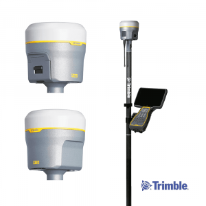
Der Trimble R12i steht an der Spitze der GNSS-Technologie und bietet Vermessungsingenieuren herausragende Genauigkeit und Effizienz. Ausgestattet mit der ProPoint™-GNSS- und TIP-Technologie liefert er selbst in anspruchsvollen Umgebungen präzise Messungen.
Dank der Echtzeit-Neigungskompensation ermöglicht er eine schnelle Datenerfassung, ohne dass die Messlatte nivelliert werden muss, was die Produktivität und Sicherheit bei der Arbeit erhöht. Der R12i verfügt über ein robustes Design, das die IP67-Standards erfüllt. Er arbeitet gut mit verschiedener Feldsoftware zusammen und wurde von Ingenieuren entwickelt, um unter schwierigen Bedingungen zuverlässige Leistung zu erbringen.
Am besten für:
- Hochpräzise Aufgaben in anspruchsvollen Umgebungen (insbesondere Rover-Einsätze)
Funktionen:
- ProPoint™ GNSS-Technologie für überlegenes Signal-Tracking
- Trimble TIP für die Neigungskompensation in Echtzeit
- Robustes Design, geeignet für raue Bedingungen
- UFH-Funkempfänger und -sender arbeiten auf 450 MHz
- Maximale Präzision von 8 mm H/15 mm V
Vorteile:
- Außergewöhnliche Genauigkeit, selbst unter Baumkronen oder in der Nähe von Gebäuden
- Effiziente Datenerfassung
Nachteile:
- Premium-Preise passen möglicherweise nicht in jedes Budget
Ideale Anwendungsfälle:
- Topografische Vermessungen
- Bauabsteckung
- Projekte, die eine hohe Genauigkeit in verdeckten Umgebungen erfordern
2. Trimble R980 ($11,999.00)
Wenn der R12i Trimbles Kraftpaket für schnelle, hochpräzise Rover-Arbeiten ist, der Trimble R980 ist sein vielseitigeres Gegenstück. Der R980 unterstützt Basis- und Rover-Setups und ist bei umfangreichen Infrastrukturprojekten sowie Teams mit vielen verschiedenen Aufgaben im Feld beliebt.
Es verfügt über dieselben fortschrittlichen ProPoint™-GNSS- und TIP-Technologien wie das R12i. Dies sorgt für Genauigkeit und Echtzeit-Neigungsausgleich in komplexen Umgebungen.
Das R980 zeichnet sich durch seine hervorragende Konnektivität aus. Es verfügt über Dual-Band-UHF, integriertes LTE und modulare Hardware. Dies ermöglicht einen flexiblen Einsatz.
Wenn Ihre Projekte über große Entfernungen kommunizieren müssen, kann der R980 helfen. Er ermöglicht auch den Rollenwechsel und bietet Ihnen so die Flexibilität, die Sie benötigen.
Am besten für:
- Vielseitige Anwendungen, die hohe Genauigkeit und Konnektivität erfordern
Funktionen:
- ProPoint™ GNSS und Trimble TIP-Technologie
- Integrierte 4G-LTE-Verbindung für die Datenübertragung in Echtzeit
- UFH-Funkempfänger und -sender arbeiten auf 450/900 MHz
- Robustes Design mit Schutzart IP67
- Basis- oder Rover-Flexibilität
- Maximale Präzision von 8 mm H/15 mm V
Vorteile:
- Nahtlose Konnektivität für Echtzeit-Korrekturen
- Konfigurierbar für mehrere Rollen
- Hervorragende Leistung in Umgebungen mit Hindernissen oder starken Interferenzen
Nachteile:
- Kann mehr Funktionen als für einfachere Projekte erforderlich umfassen
- Etwas schwerer als zweckgebundene Rover-Einheiten
Ideale Anwendungsfälle:
- Verkehr und Infrastrukturentwicklung
- Versorgungs- und Bergbauprojekte
- Mehrbesatzungs-Projekte, die einen modularen Aufbau erfordern
3. Trimble R780 ($6,999.00)
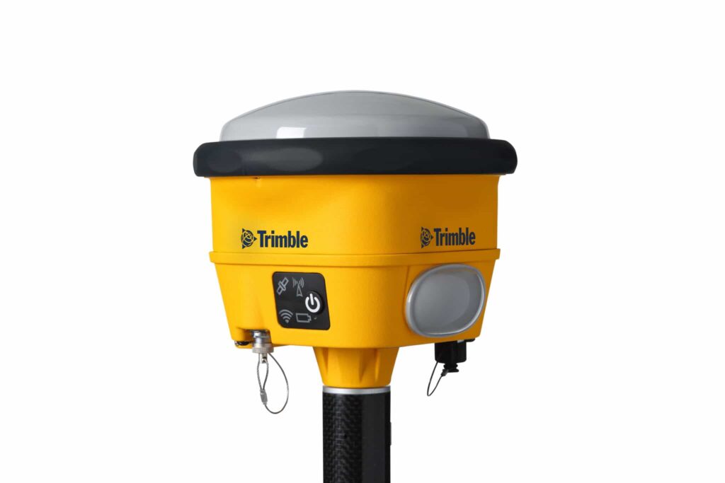
Der Trimble R780 ist ein extrem robustes GNSS-Empfangsgerät, das für den anspruchsvollen Baustellen- und Industriebetrieb entwickelt wurde. Dieses Modell hält Vibrationen, Stürzen und extremen Wetterbedingungen ohne Unterbrechung stand.
Es verfügt über Trimble xFill, das das System bei kurzen Signalverlusten weiterlaufen lässt. Diese Funktion ist wichtig für die Arbeit in abgelegenen oder blockierten Gebieten.
Der R780 ist sehr anpassbar, was ihn zu einer großartigen Wahl für Vermessungsteams macht. Sie benötigen ein Gerät, das als Basis oder Rover arbeiten kann. Er passt sich an verschiedene Anwendungen an, von der einfachen Datenerfassung bis hin zu komplexen Echtzeit-Kinematik-Vermessungen (RTK).
Am besten für:
- Standorte und Umgebungen, die robuste Ausrüstung erfordern
Funktionen:
- Trimble xFill für nahtlose Leistung
- Basis- oder Rover-Konfiguration
- Fortschrittliche Positionierungs-Engine mit Unterstützung für mehrere GNSS-Konstellationen
- Trimble TIP für die Neigungskompensation in Echtzeit
- Erweiterte Trimble RTX™ Technologie
- UFH-Funkempfänger und -sender arbeiten auf 450/900 MHz
- Maximale Präzision von 8 mm H/15 mm V
Vorteile:
- Überragende Langlebigkeit für raue Umgebungen
- Erhält die Produktivität auch bei GNSS-Ausfällen aufrecht
- Lange Batterielebensdauer für den ganztägigen Außeneinsatz
Nachteile:
- Schwerer als kompaktere Vermessungsempfänger
- Vielleicht für leichte Feldarbeiten überdimensioniert
Ideale Anwendungsfälle:
- Großbau-, Landwirtschafts- und Versorgungsprojekte
- Bergbauarbeiten
- Baustellen, die anfällig für Signalverlust sind
4. Trimble R2 Integriertes GNSS-System ($4,500.00)
Der Trimble R2 ist ein kleiner, leichter GNSS-Empfänger. Er richtet sich an GIS-Fachleute und Vermessungsingenieure, die Mobilität schätzen und sich mit Smart-Geräten verbinden möchten. Trotz seiner geringeren Größe kann er alle verfügbaren Konstellationen einschließlich GPS, GLONASS, Galileo, BeiDou und SBAS empfangen.
Bluetooth ermöglicht dem R2 eine einfache Verbindung mit Feldrechnern, Tablets und Smartphones. Dies macht ihn zu einer beliebten Wahl für Teams, die geodätische Daten erfassen, ohne einen schweren Rover-Stab zu benötigen. Die Portabilität des Geräts ermöglicht es Benutzern, es auf Rucksäcken und Fahrzeugen zu montieren.

Am besten für:
- GIS-Fachleute und Projekte, die Flexibilität erfordern
Funktionen:
- Kompaktes, kabelloses Design für die Handhabung
- Bluetooth-Konnektivität mit Android-, iOS- und Windows-Geräten
- Eintatzen-Start
- IP65-zertifiziert
- UFH-Radio empfängt 450 MHz
- Maximale Genauigkeit von 10 mm H/20 mm
Vorteile:
- Äußerst portabel und leicht zu transportieren
- Funktioniert mit einer Vielzahl von Geräten und Apps
- Großartig für die Datenerfassung auf großen Standorten
Nachteile:
- Nicht für vermessungstechnische Präzision in komplexen Umgebungen ausgelegt
- Weniger fortschrittliche Verbesserungen im Vergleich zu größeren Modellen
Ideale Anwendungsfälle:
- Umweltverträglichkeitsprüfungen
- Leitungskataster
- Inventarverzeichnis
- Mobiles georeferenziertes Datenerfassen
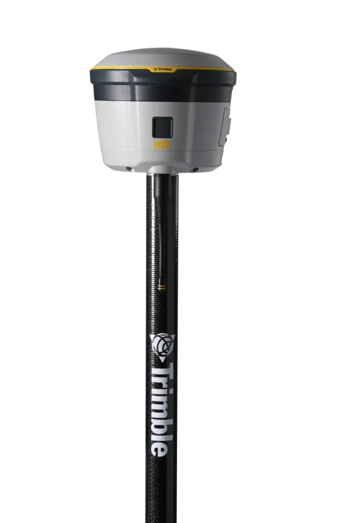
5. Trimble R580 ($5,999.00)
Für Vermessungsingenieure, die eine gute Leistung zu einem vernünftigen Preis suchen, ist der Trimble R580 ist eine großartige Wahl. Sie bietet eine genaue Positionierung. Außerdem verfügt sie über eine schnelle Signalerfassung.
Der Trimble R580 nutzt dieselbe ProPoint™ GNSS-Engine wie die Top-Empfänger von Trimble und ist damit eine zuverlässige Wahl für tägliche Vermessungsaufgaben.
Sein leichtes, integriertes Design und die Unterstützung für Trimble CenterPoint RTX-Korrekturen machen es zu einer guten Wahl für Grenzvermessungen und allgemeine Vermessungsarbeiten.
Am besten für:
- Vermessungsingenieure, die nach einem Gleichgewicht zwischen Leistung und Erschwinglichkeit suchen
Funktionen:
- Trimble ProPoint™ GNSS-Technologie
- Integrierte Antenne für kompakte Portabilität
- Militärtaugliches, robustes Design
- UFH-Radio empfängt 450 MHz
- Maximale Genauigkeit von 10 mm H/20 mm V
Vorteile:
- Liefern Sie hohe Genauigkeit zu einem mittleren Preis
- Schnelle Einrichtung und einfache Bereitstellung
- Gutes Preis-Leistungs-Verhältnis für allgemeine Vermessungsarbeiten
Nachteile:
- Es fehlen Funktionen wie Titelvergütung oder modulare Rollen.
- Nicht geeignet für extreme Umgebungen oder starke Störungen
Ideale Anwendungsfälle:
- Grenzvermessungen
- Baupläne
- Allgemeine tägliche Vermessungsarbeiten
Vergleichstabelle: Trimble GPS-Modelle im Überblick
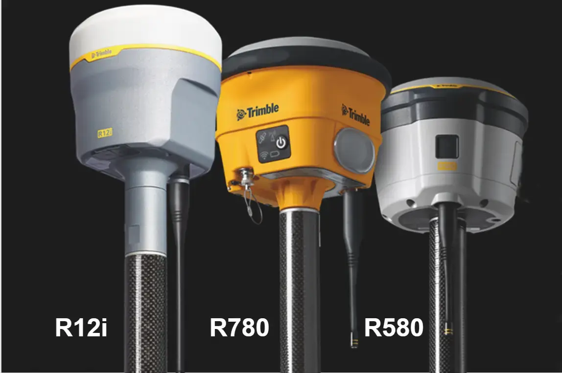
Hier ist eine einfache Trimble-GPS-Vergleichstabelle. Diese hilft Ihnen, die beste Vermessungsausrüstung für Ihr Projekt zu finden.
| Modell | Am besten geeignet für | Hauptmerkmale | Maximale Präzision | Vorteile | Nachteile |
| Trimble R12i | Hochpräzise Aufgaben in anspruchsvollen Umgebungen | ProPoint™ GNSS, TIP, 450 MHz UHF, IP67, Neigungsausgleich | 8 mm H / 15 mm V | Außergewöhnliche Genauigkeit, schnelle neigungsfähige Datenerfassung | Höchstpreis |
| Trimble R980 | Vielseitige Anwendungen mit hoher Genauigkeit und Konnektivität | ProPoint™ GNSS, TIP, 450/900 MHz UHF, LTE, IP67, Basis/Rover | 8 mm H / 15 mm V | Nahtlose Konnektivität, flexible Konfiguration | Schwerer, für einfache Aufgaben möglicherweise überdimensioniert |
| Trimble R780 | Raue Umgebungen und Baustellen | xFill, Multi-GNSS, TIP, RTX, 450/900 MHz UHF, Basis/Rover | 8 mm H / 15 mm V | Hohe Langlebigkeit, lange Batterielaufzeit | Schwer, für leichte Anwendungen möglicherweise übertrieben |
| Trimble R2 | GIS-Fachleute und mobile Projekte | Kompakt, Bluetooth, SBAS, IP65, 450 MHz | 10 mm H / 20 mm V | Tragbar, mit Mobilgeräten kompatibel, einfache Einrichtung | Geringere Präzision, weniger erweiterte Funktionen |
| Trimble R580 | Ausgewogene Leistung und Erschwinglichkeit | ProPoint™ GNSS, integrierte Antenne, 450 MHz, RTX | 10 mm H / 20 mm V | Hohe Genauigkeit bei geringeren Kosten, schnelle Implementierung | Keine Neigungskompensation, nicht ideal für Standorte mit hohen Interferenzen |
Abschließende Gedanken: Welches Trimble GPS ist das richtige für Sie?
Auswahl des Besten Trimble-GPS für Vermessungsarbeiten hängt von Ihren Projektanforderungen, den Arbeitsbedingungen und dem Budget ab. Wenn Sie hochpräzise Arbeiten in verdeckten Umgebungen durchführen, ist der Trimble R12i kaum zu schlagen.
Für große Teams, die im Außeneinsatz nahtlose Konnektivität benötigen, bietet das R980 leistungsstarke Echtzeit-Funktionalität. Wenn Sie ein Gerät suchen, das den Elementen standhält, ist das R780 selbst für die härtesten Einsatzorte geeignet. Für mobile Teams ist das R2 flexibel und leicht zu transportieren. Das R580 bietet ein gutes Preis-Leistungs-Verhältnis für die täglichen Vermessungsanforderungen.
Ganz gleich, für welches Modell Sie sich entscheiden – Trimble bietet Lösungen, die Produktivität, Genauigkeit und Zuverlässigkeit steigern. Entdecken Sie unser Angebot unser gesamtes Trimble-GPS-Inventar, oder kontaktieren Sie unser Team für eine fachkundige Beratung.
FAQ: Trimble GPS für die Vermessung
Was ist das genaueste Trimble-GPS-Gerät für Vermessungsingenieure?
Der Trimble R12i ist derzeit der fortschrittlichste GPS-Empfänger von Trimble für Vermessungsgenauigkeit. Er kombiniert ProPoint™ GNSS, die Trimble TIP-Neigungskompensation und eine fortschrittliche Signalfilterung.
Kann ich Trimble GPS in abgelegenem oder unwegsamem Gelände verwenden?
Ja, Sie können Trimble-GPS in abgelegenem oder unwegsamem Gelände verwenden. Designer entwickeln Modelle wie den Trimble R780 speziell für raue Umgebungen und widrige Wetterbedingungen.
Was ist der Unterschied zwischen dem Trimble R10 und dem R12i?
Der R12i ist die Weiterentwicklung der nächsten Generation des R10. Er verfügt über ProPoint™ GNSS für eine bessere Signalverfolgung und Echtzeit-Neigungskompensation. Dies hilft Teams, schnell und präzise zu arbeiten, ohne Zeit mit dem Ausrichten von Vermessungsstäben zu verschwenden. Außerdem liefert er bessere Ergebnisse unter Bewuchs und in der Nähe von Gebäuden.
Benötigen Trimble GPS-Geräte ein Abonnement oder eine Lizenz?
Einige Trimble-Modelle erfordern ein Abonnement oder eine Lizenz für erweiterte Funktionen. Abhängig von Ihrem Arbeitsablauf und Ihrer Region benötigen Sie möglicherweise auch einen Datentarif für die Mobilfunkverbindung. Bestätigen Sie den Lizenzbedarf für Ihr spezifisches Produkt vor dem Kauf oder Einsatz.
Wo kann ich echte Trimble GPS-Geräte kaufen?
Zertifizierte Trimble-GPS-Systeme können direkt bei Gemoatrics Land Surveying erworben werden. Als autorisierter Händler bietet das Unternehmen Produktunterstützung, fachkundige Beratung und Original-Hardware von Trimble an.
 English
 Spanish
 French
 German